|
Conclusions
As you know, rivers eventually
overflow their banks and flood. Flooding is a
natural process. It also can be a very costly
natural disaster causing loss of life and
millions or even billions of dollars in property
damage. Being able to predict the frequency
(Recurrence Interval) and likelihood
(probability) of flooding as well as the
magnitude of floods (maximum peak discharge) can
be used by land use planners to help reduce the
potential hazards. Flood forecast maps can be
prepared to help people decide where to live in
relation to rivers. Flood warning systems can be
developed and used to reduce the loss of
life.
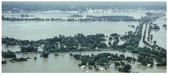
In 1993, heavy springtime
precipitation resulted in weeks of major flooding
throughout the upper Mississippi River system and
caused about $20 Billion in damage. The picture
below shows the area near the intersection of the
Missouri and Mississippi Rivers.
For more information about
flooding you can visit a number of web sites,
such as FEMA, or the United States Geological
Survey's Natural Disaster's site.
If you would like to obtain a
"Certificate of Completion" for this flooding
activity, click the "Next" button
below.
|